Our Services

Land Surveyor

Boundary Surveys

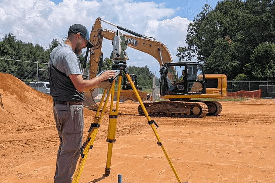
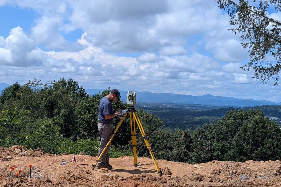
Boundary surveys are one of the most important steps in protecting your property and making informed land decisions. At Leadbitter Land Surveying PA, we provide precise boundary surveys that define property lines with legal accuracy—whether you're preparing to sell, settle a boundary dispute, build a fence, or divide land among family members.

Our surveys are especially valuable in real estate transactions, where clean, verifiable property lines help prevent closing delays or future conflicts. Using modern equipment and proven field techniques, we locate and mark boundaries according to deed descriptions, plat maps, and state surveying standards.

With more than 20 years of experience across Western North Carolina—including Buncombe, Haywood, Madison, Mitchell, Avery, and Yancey counties—we understand the challenges posed by mountain terrain, overlapping deeds, and older properties. Our team delivers clear documentation and, when needed, physical markers to give you confidence in your property’s limits. Whether you're a homeowner, developer, or attorney, we’ll help you move forward with clarity and peace of mind.
Contact Us
Land Surveyor

Construction Layout & Staking

Getting a structure in the right place starts long before the first concrete is poured. Construction layout, also known as staking, is the process of translating engineered site plans into precise physical markers on the ground—defining where curbs, foundations, sewer lines, and other infrastructure will actually be built. It’s a critical step in commercial, residential, and subdivision projects.

Leadbitter Land Surveying PA brings a level of construction insight that few local firms offer. With decades of experience working directly alongside contractors, utility crews, and site developers, we understand how plans need to function in the real world—not just on paper. That means accurate grades, correctly placed reference points, and efficient coordination with your build schedule.

From small commercial pads to large-scale subdivision infrastructure, we provide dependable layout services that help avoid costly rework and keep your project on track. We also support coordination with engineers, architects, and inspectors to make sure everything aligns from the ground up.
Contact Us
Excavator ge8b123de7 1920

Grading & Site Prep Guidance

Before construction can begin, the land has to be shaped—and shaped correctly. Grading is the process of leveling, sloping, cutting, or filling a site to meet design requirements for drainage, elevation, and build readiness. At this stage, precision matters. Too much cut or fill can lead to delays, added cost, and future structural issues.

Our team offers grading guidance that goes beyond basic elevation checks. We provide on-site guidance to heavy machinery operators, ensuring the land is prepared exactly to spec. This service is especially valuable for steep or uneven mountain lots, where grading can be the most complex part of the build.

With grading making up a significant portion of our work, we know how to help builders avoid guesswork and move confidently from raw land to ready-to-build.
Contact Us
Excavator ga6e3abc80 1920

Residential & Home Layout

Placing a home on a lot is about more than just following a plan—it’s about making the design work with the land. We provide precise home layout services that help builders and architects position homes exactly where they’re intended to go, aligning with site plans, setback requirements, elevation goals, and even aesthetic considerations like views and orientation.

Our layout services are especially valuable on sloped or irregular lots common in the Western North Carolina region. We work closely with custom homebuilders, architects, and project managers to mark foundation corners, setbacks, and critical elevation points—ensuring everything fits the plan before excavation or footers begin.

This kind of precision early in the process saves time, prevents delays, and gives your team the confidence to build with accuracy from day one.
Contact Us
Land Surveyor

Elevation Certificates & Compliance

For properties in or near flood zones, an elevation certificate is often required for insurance purposes, permitting, or FEMA documentation. This certificate verifies the elevation of a structure or build site relative to base flood elevation (BFE), helping determine flood risk and insurance requirements.

We provide accurate, certified elevation surveys that meet FEMA standards and local regulations. Whether you’re building a new home, making improvements, or adjusting your insurance policy, we deliver the documentation needed to keep your project or transaction moving smoothly.

Elevation work can be especially complex in mountain regions, where natural grades and waterways create unique challenges. With our experience in Western North Carolina terrain, we ensure your certificate is both accurate and defensible—providing peace of mind for homeowners, lenders, and insurers alike.
Contact Us

Secure Your Property's Future Today!

Reach out to Leadbitter Land Surveying PA for expert land surveying services in Weaverville, NC. Our skilled team is ready to deliver the precision and clarity you need for your property endeavors.
Contact Us Now